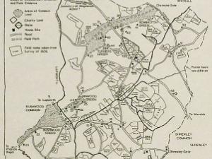
1 OS map showing Parish boundary
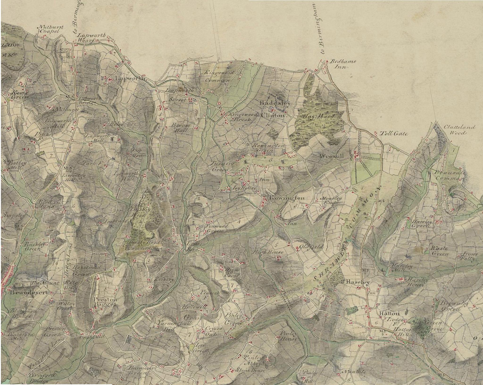
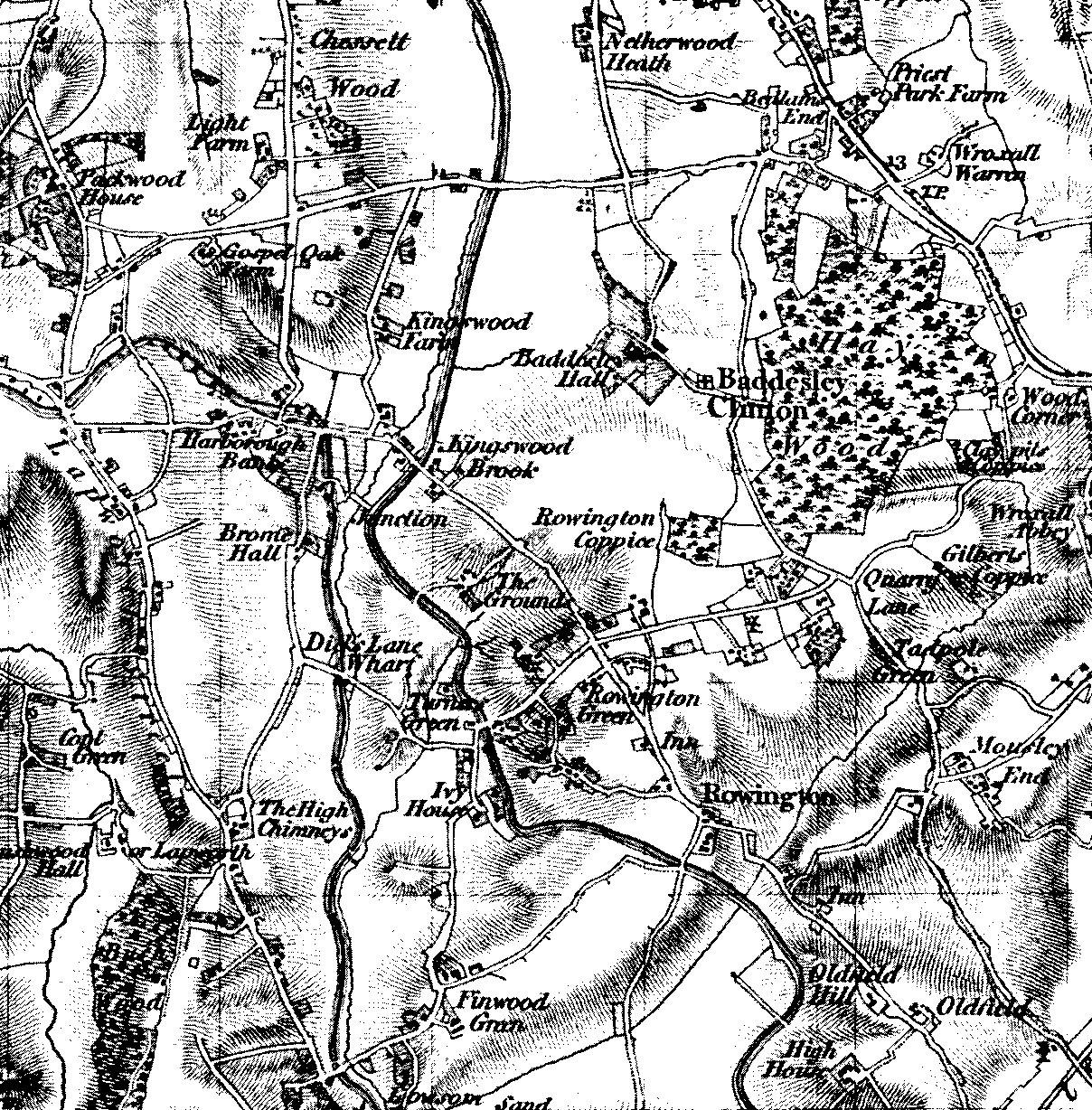
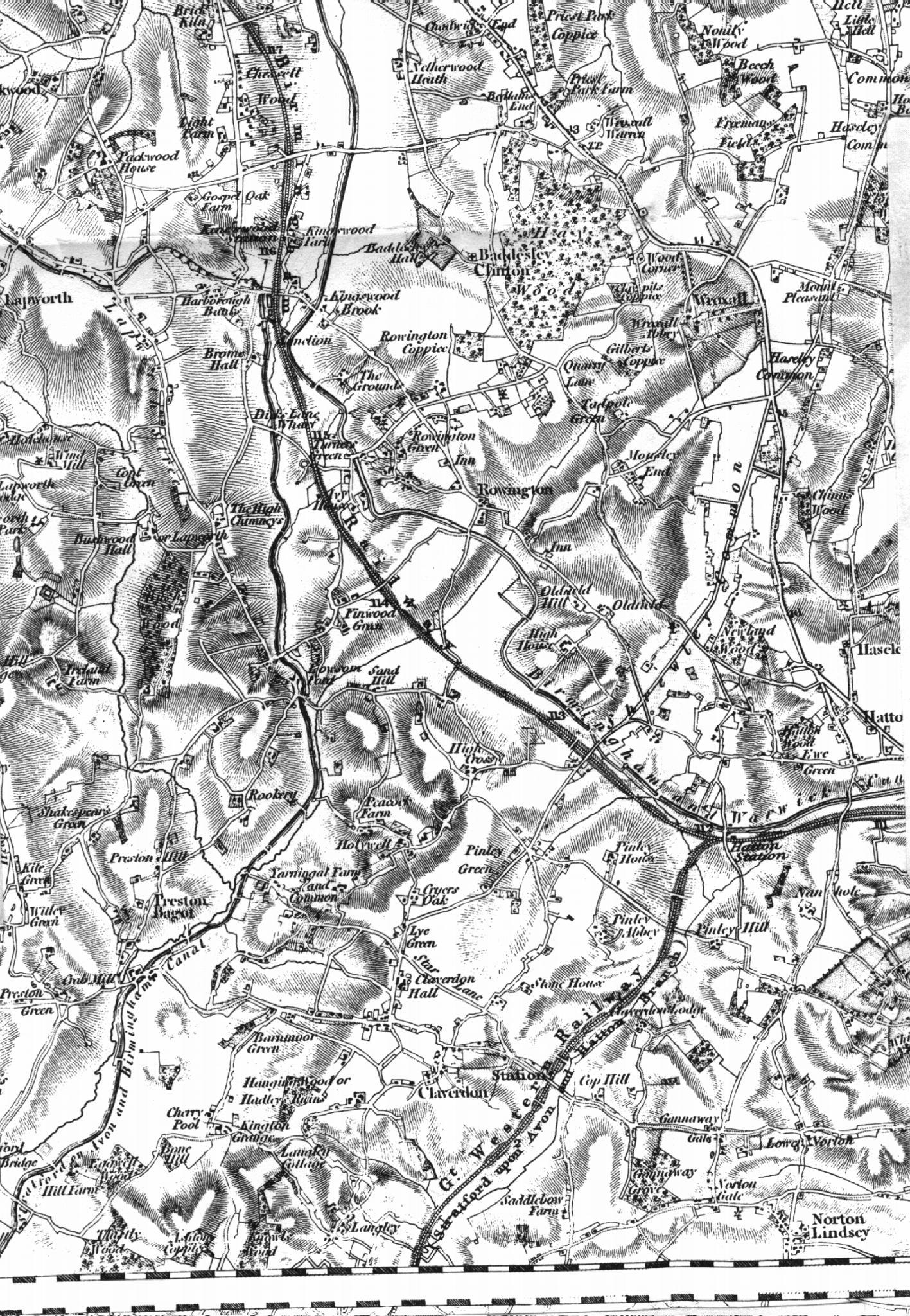
2 Original 1814 Ordnance Survey map of Rowington area
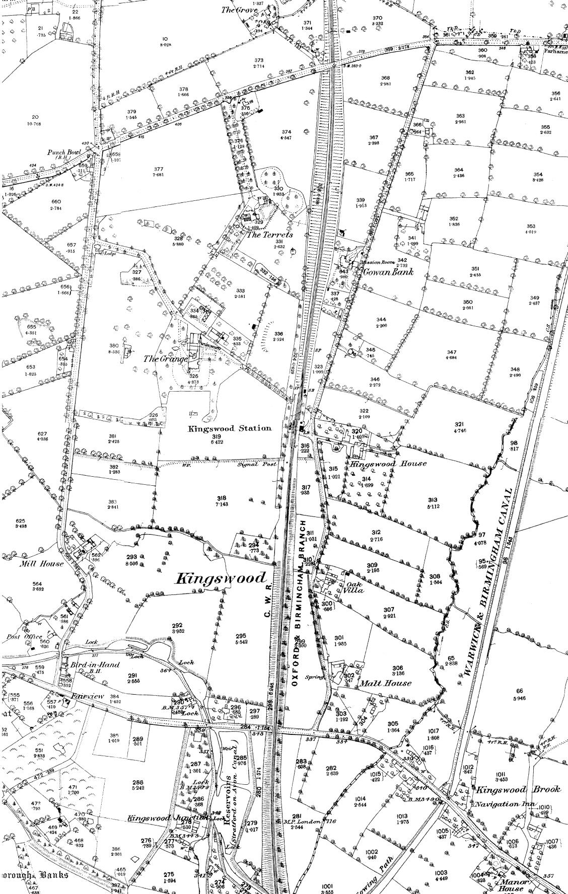
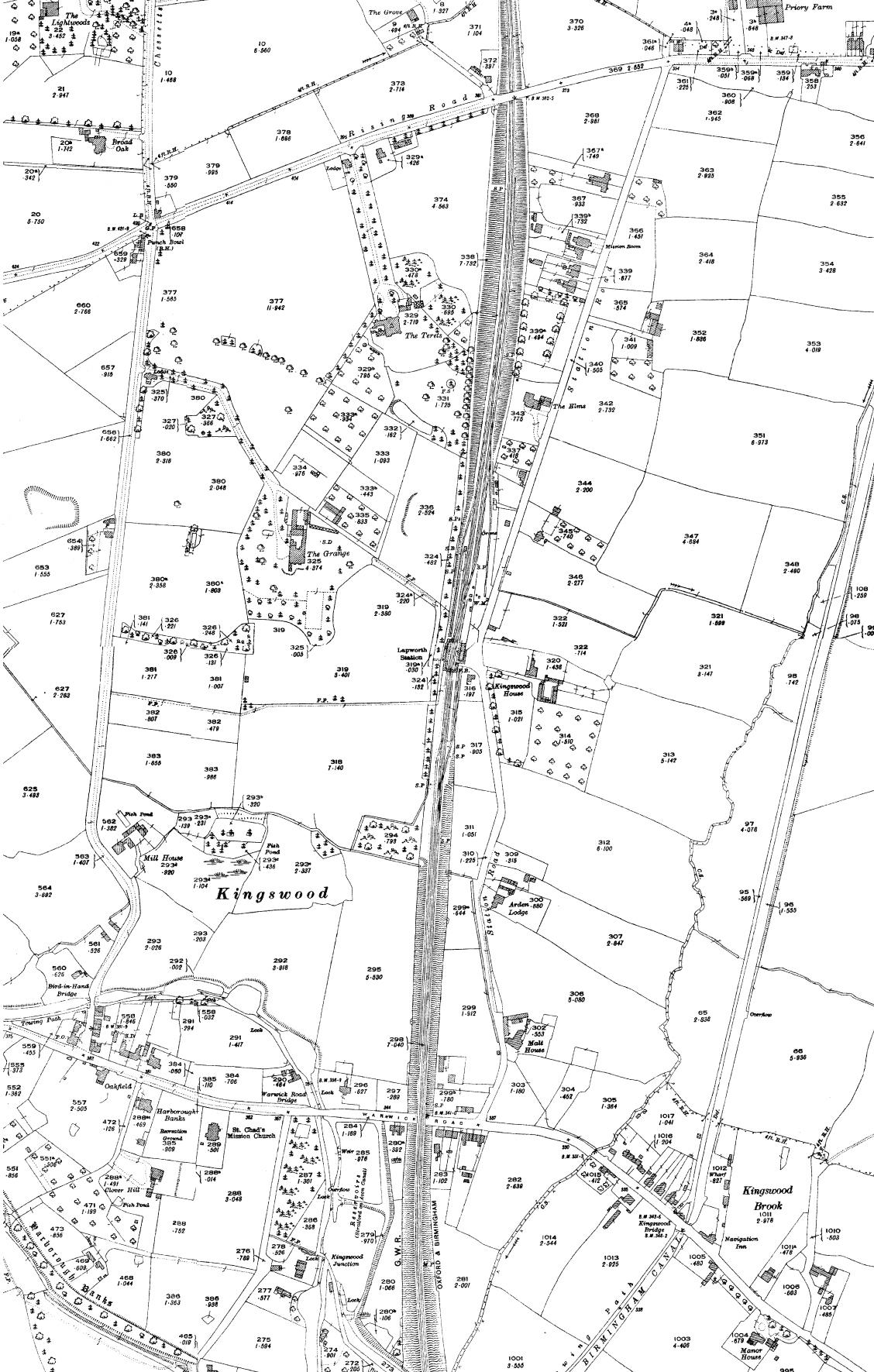
3 Map of Kingswood from 1887. Compare with map of same area from 1825 to see the rapid development that followed the arrival of the railway
4 Map of Kingswood from 1925. Compare with map of same area from 1887 to see the rapid development that followed the arrival of the railway
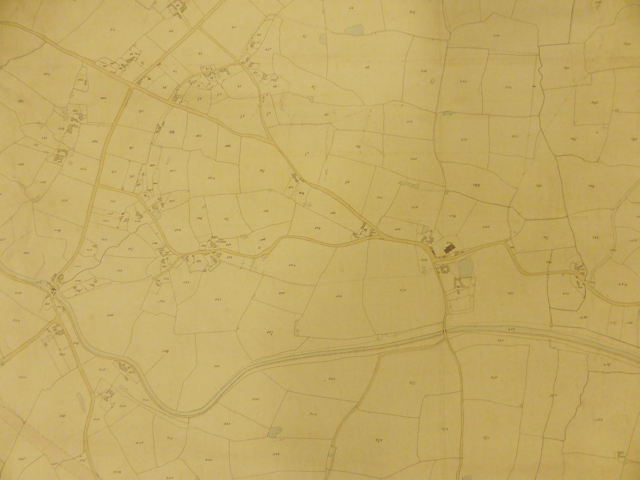
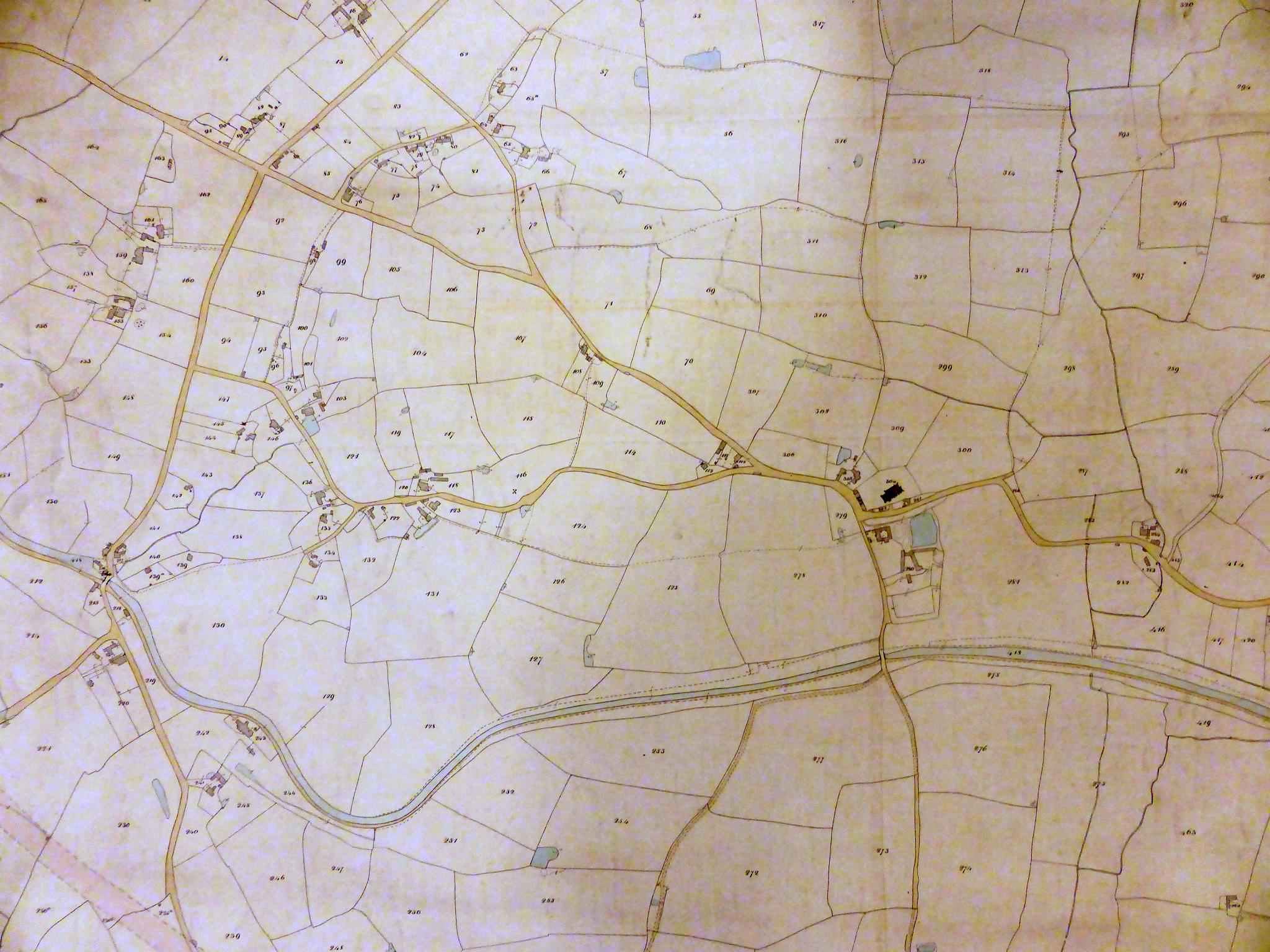
5 Part of the 1847 Rowington Tithe Map showing the central part of Rowington village. A complete transcription of the Tithe Apportionment book, showing the field names, owners and occupiers fully cross referenced to the newer OS field numbers can be downloaded as a PDF here. The same document, but in OS field number sequence, rather than Tithe Map plan number sequence can be downloaded as a PDF here.
6 Part of the 1847 Rowington Tithe Map showing the central part of Rowington village. A complete transcription of the Tithe Apportionment book, showing the field names, owners and occupiers fully cross referenced to the newer OS field numbers can be downloaded as a PDF here. The same document, but in OS field number sequence, rather than Tithe Map plan number sequence can be downloaded as a PDF here.
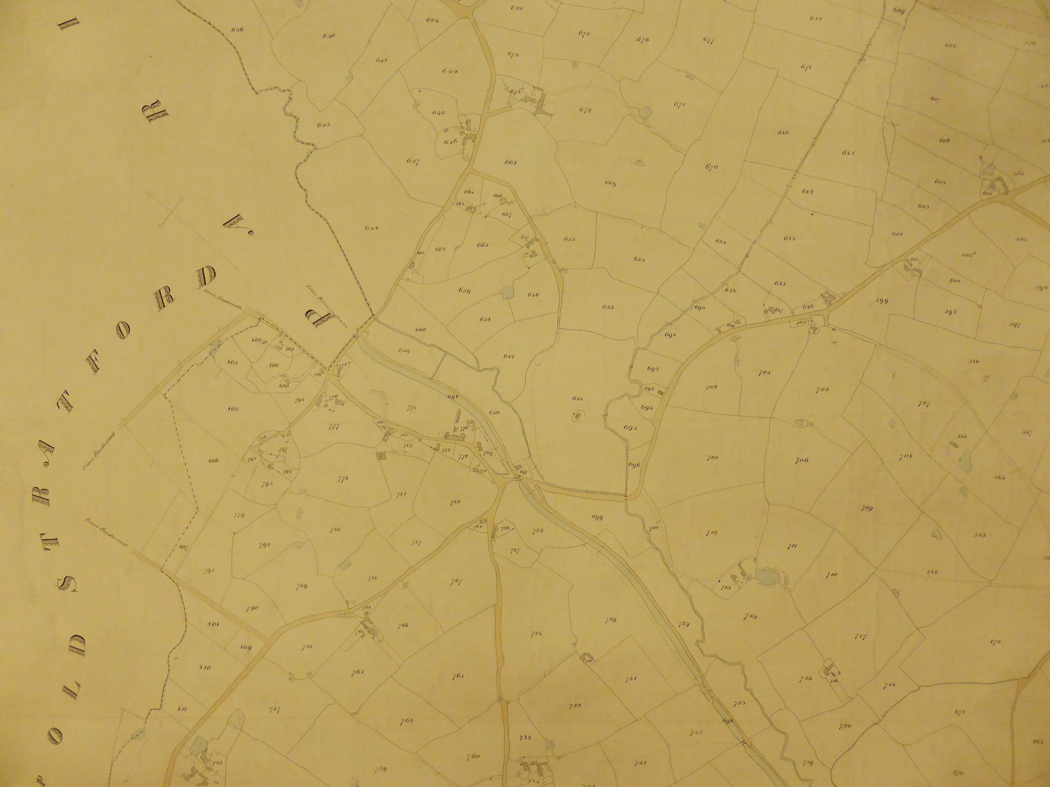
7 Part of the 1847 Rowington Tithe Map showing the central part of Lowsonford village. A complete transcription of the Tithe Apportionment book, showing the field names, owners and occupiers fully cross referenced to the newer OS field numbers can be downloaded as a PDF here. The same document, but in OS field number sequence, rather than Tithe Map plan number sequence can be downloaded as a PDF here.
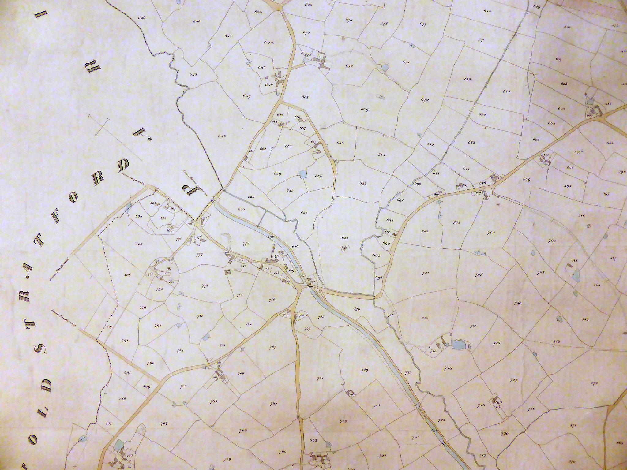
8 Part of the 1847 Rowington Tithe Map showing the central part of Lowsonford village. A complete transcription of the Tithe Apportionment book, showing the field names, owners and occupiers fully cross referenced to the newer OS field numbers can be downloaded as a PDF here. The same document, but in OS field number sequence, rather than Tithe Map plan number sequence can be downloaded as a PDF here.
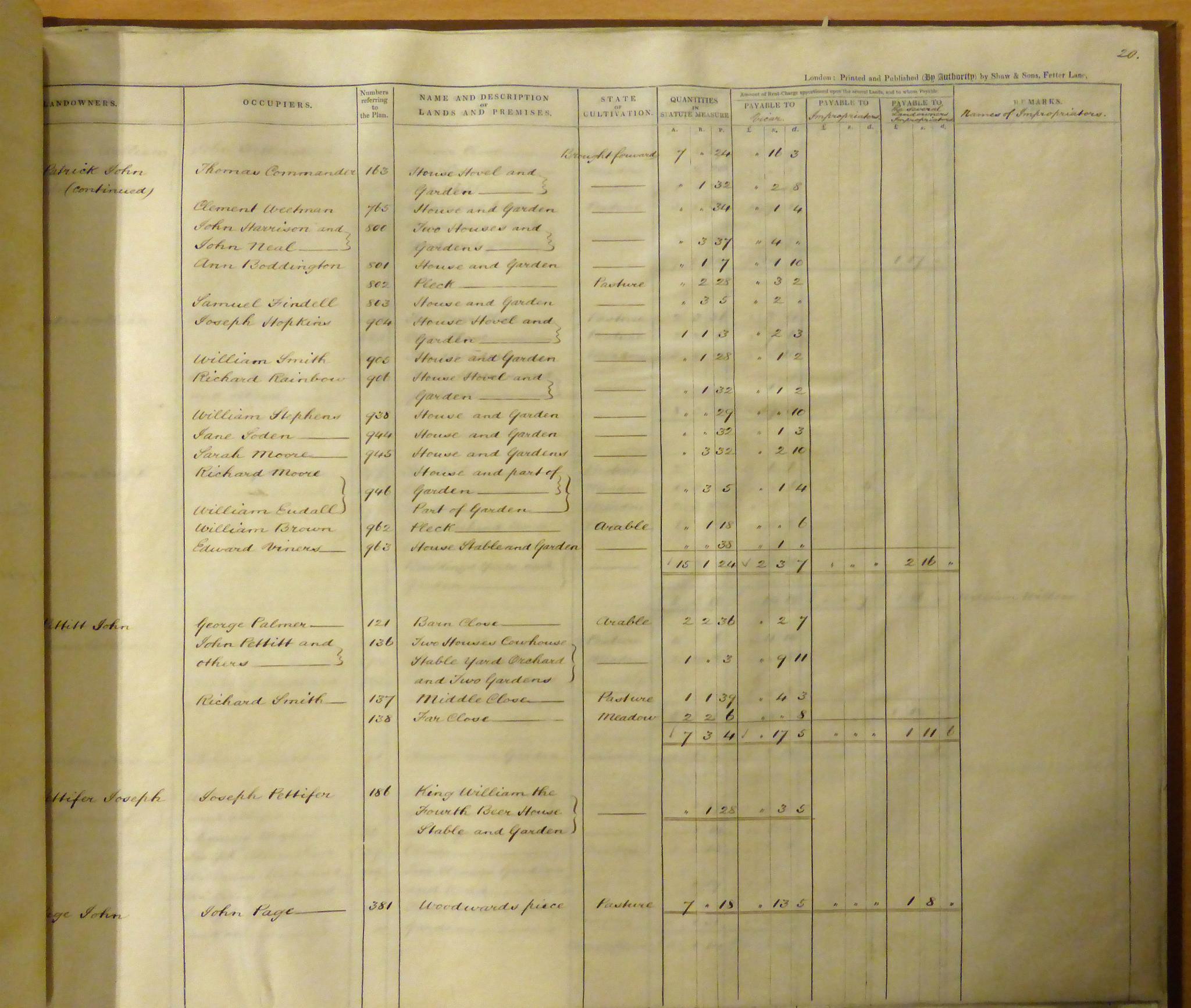
9 One of the pages of the Tithe Apportionment book which cross references plot numbers on the tithe map to field names, land owners and occupiers. A complete transcription of the Tithe Apportionment book, showing the field names, owners and occupiers fully cross referenced to the newer OS field numbers can be downloaded as a PDF here. The same document, but in OS field number sequence, rather than Tithe Map plan number sequence can be downloaded as a PDF here.
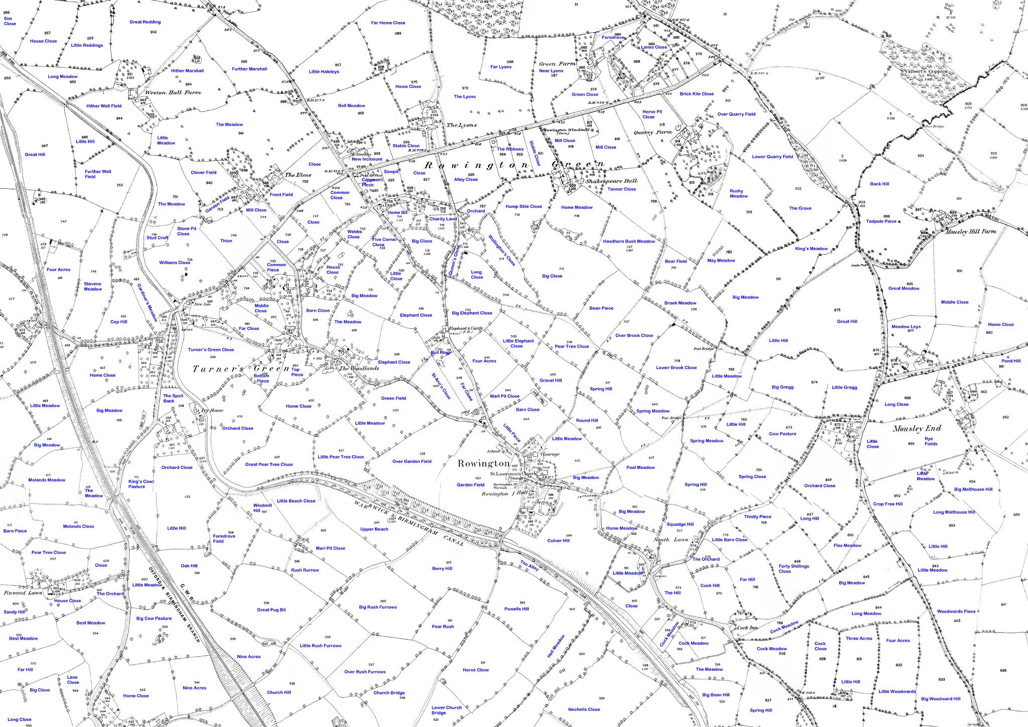
10 The 1887 OS map of Rowington annotated with the field names taken from the 1848 tithe map. The same map can be downloaded here as a large scale PDF file to zoom in on the detail. See the sample images of the Tithe Map in this folder for links to the complete transcription of the Tithe Apportionment Book which contains the field names for the whole Parish.
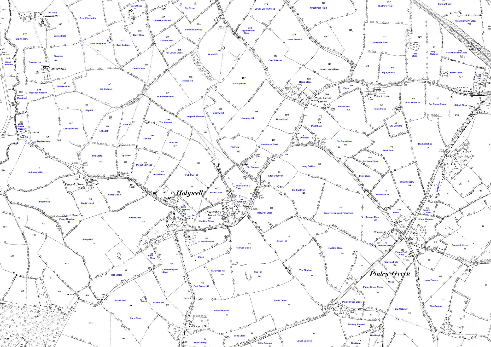
11 The 1887 OS map of Holywell and Pinley annotated with the field names taken from the 1848 tithe map. The same map can be downloaded here as a large scale PDF file to zoom in on the detail. See the sample images of the Tithe Map in this folder for links to the complete transcription of the Tithe Apportionment Book which contains the field names for the whole Parish.
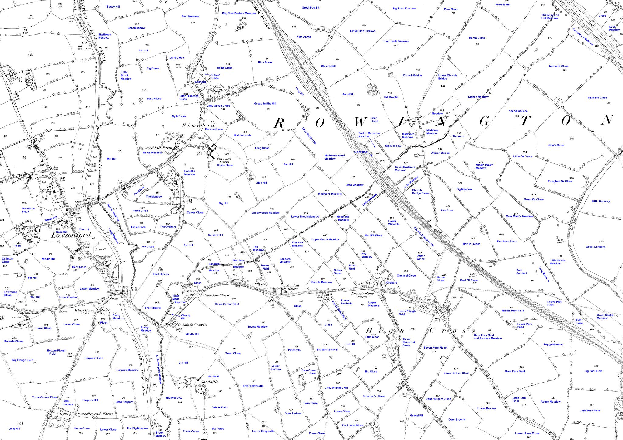
12 The 1887 OS map of Lowsonford annotated with the field names taken from the 1848 tithe map. The same map can be downloaded here as a large scale PDF file to zoom in on the detail. See the sample images of the Tithe Map in this folder for links to the complete transcription of the Tithe Apportionment Book which contains the field names for the whole Parish.
13
14
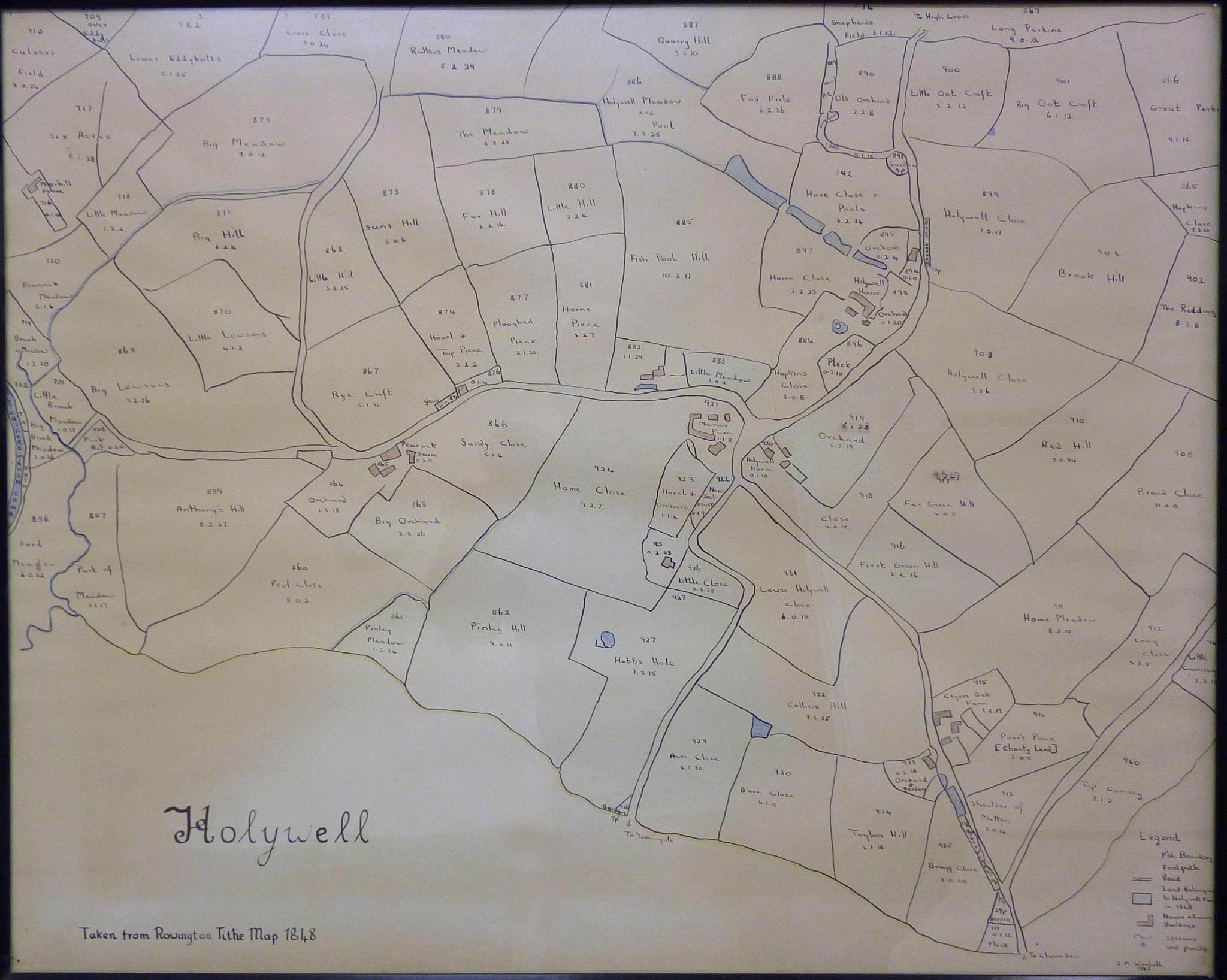
15 Holywell field names from 1848 Tithe Map
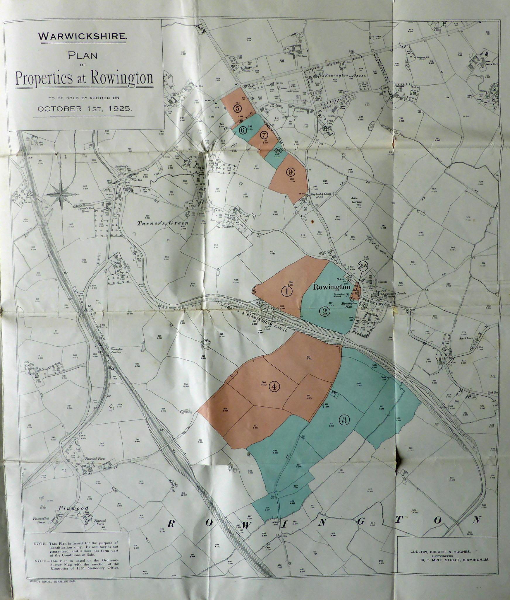
16 Map from Sale of Rowingtoon Hall Estate 1925
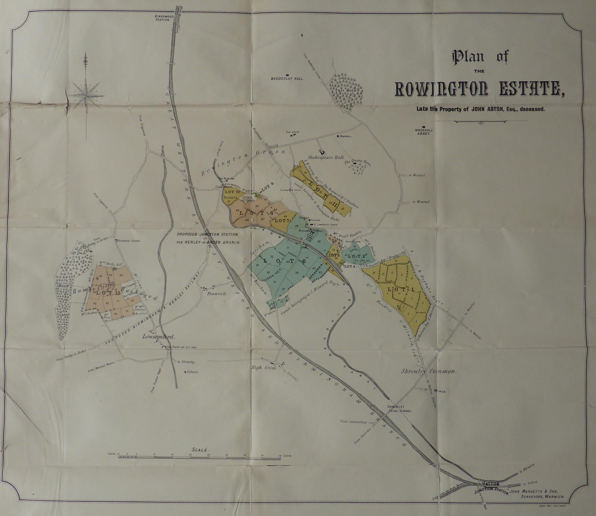
17 Plan of Rowington Estate - 1891 Sale details Rowington Hall, Oldfield Farm, Foxbrook House, Bushwood and other land on death of John Aston
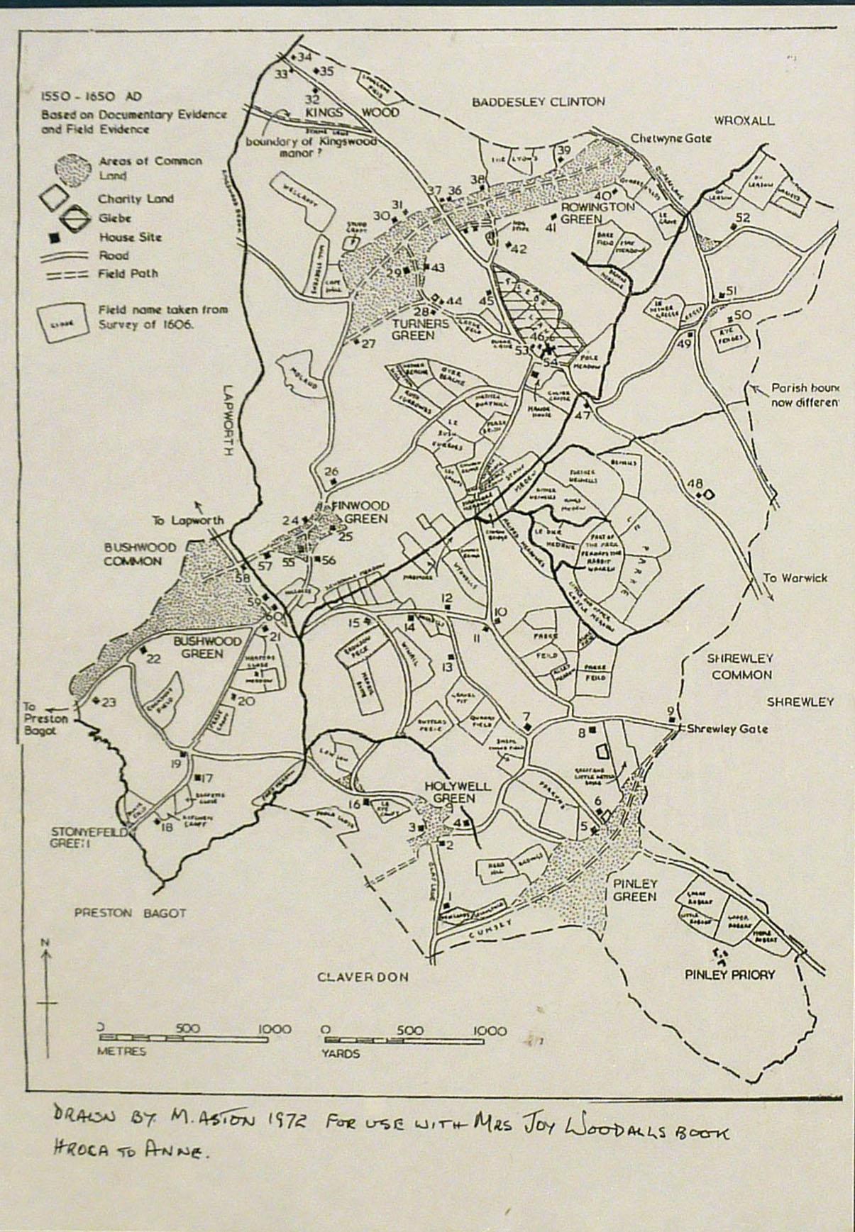
18 16th & 17th Century Field Names
19 Kingswood Common